West Kaysville Impact Comparison = EAST of Powerlines vs. WEST of Powerlines
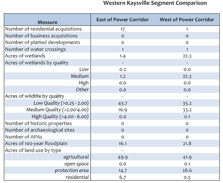
The table above IS UDOT'S REASONING FOR MOVING THE HIGHWAY EAST OF THE POWERLINES! Look at it closely.... it takes more wetlands West of the lines but more agricultural land and HOMES east of the powerlines. It takes more acres of wildlife by quality when it goes EAST of the powerlines as well. Again, THIS IS THE DATA THAT IS PUSHING THE ROAD EAST AND TAKING HOMES.... Study this information well, then submit your comments to UDOT. This info came from UDOT's own website, so decide for yourself whether these statistics warrant demolition of home or not!
NORTH LEGACY CORRIDOR STUDY FROM 2001
The following link will take you to a page by the Wasatch Front Regional Council that shows all sorts of data from a 2001 study of what was then being referred to as the "North Legacy Corridor." It has a lot of maps and diagrams showing routes which appear to be WEST of the Kaysville Power lines. http://www.wfrc.org/cms/index.php?option=com_content&view=article&id=96:north-legacy-
corridor-study-2001&catid=24&Itemid=38
"MASTER PLANS" from cities affected by the future highway can be found at the link below. Note the 2008 date and route running WEST of the powerlines in the Kaysville City plan. To view the city plans, scroll to the very bottom of the page at the following link:
http://www.udot.utah.gov/westdavis/documentation
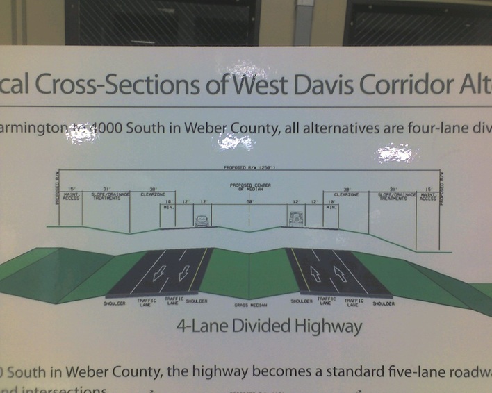
The above is a UDOT chart detailing how wide the new highway would be. (250 feet total) If you live along the power lines in West Kaysville, this illustrates how far East the road would extend from the power lines at minimum. For residents in the ViewCrest and Wellington areas, this would DIRECTLY IMPINGE on yards and homes to cover the allotted 250ft space.
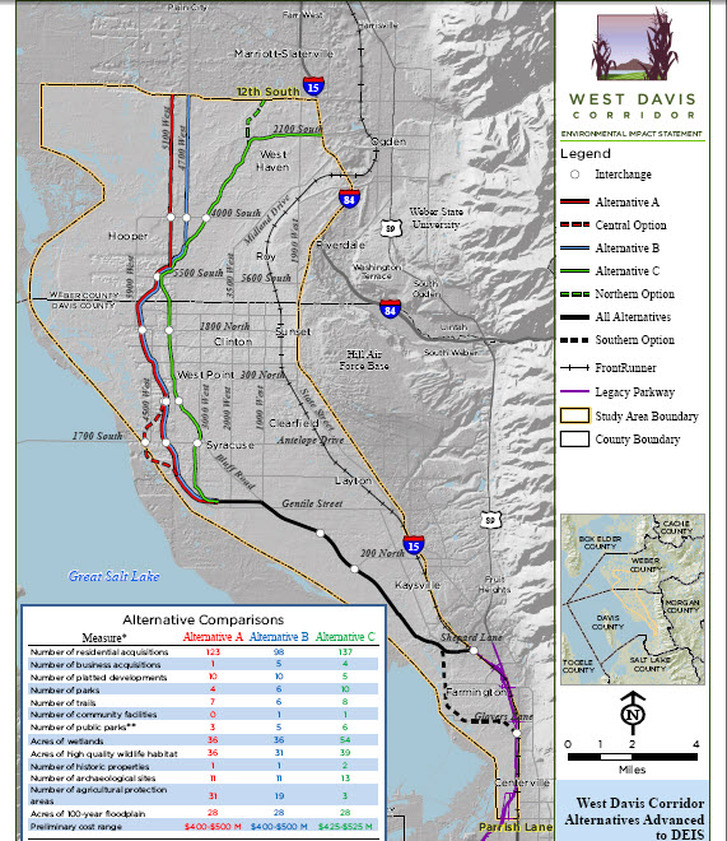
The Above map was distributed by UDOT at the Open Houses and is also available on the UDOT website. It illustrates the 3 proposed routes currently under consideration, and the number chart in the lower left lists specific numbers of homes, businesses, parks, wetlands, wildlife habitat, trails, etc that would need to be demolished to complete the route.
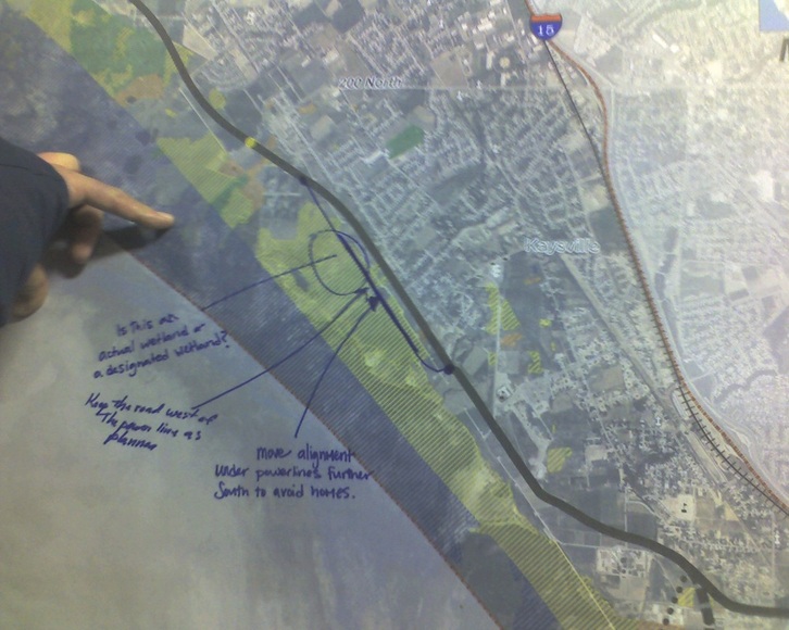
The map above was displayed at UDOT Open Houses by their EIS (environmental impact) representative, Vince Izzo. Mr. Izzo explained that the yellow areas represent areas that UDOT has designated as "Wetlands." It should be noted that NO Utah state, county, forest service, topographical maps/charts, etc are currently listing or designating the same areas as Wetlands. There is also NO designation of wetlands in this area from the Army Corps of Engineers, which is the agency who would normally designate wetlands in the state.
When asked what criteria UDOT used to create the map above and designate Wetlands, Mr. Izzo told residents that "a guide manual from 1987 that has descriptions of what designates wetlands was used by UDOT biologists to create this map." Interesting that no other agency has heretofore made the same designations, and also noteworthy that a 24 year old manual was the guide for the study.
We will leave it up to you to make your own individual judgement as to the validity of UDOT's wetland data based on this information....